


| Availability: | Out of stock |
| Available in store: | Check availability |
CANADA’S PREMIER BACKCOUNTRY MAPS AND OUTDOOR RECREATION GUIDES.
BRMB’s classic printed Backroad Mapbooks have been guiding outdoor adventures of all shapes and sizes through the Canadian Backcountry for over a quarter century. These durable, spiral-bound 21.5 x 28 cm (8.5 x 11 in) Mapbooks provide you with industry leading cartographic detail and topographic relief, unparalleled road and trail coverage, thousands of adventure POIs and tons of adventure information, from camping to fishing, hunting, hiking, ATVing and beyond. No other recreation maps offer this level of detail or this amount of adventure information, with complete coverage from the coast of BC to the shores of Newfoundland.
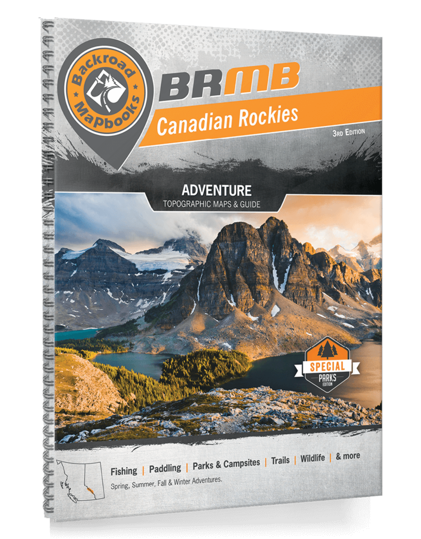
CANADIAN ROCKIES
Map Features: Attractions, ATVing, Camping, Fishing, Hiking, Hunting, Paddling, Skiing, Snowmobiling, Hydrology, logging and industry roads
Areas Covered: Banff, Elk Lakes, Jasper, Kootenay National Park, Hamber Provincial Park, Height of the Rockies, Kakwa, Lake Louise, Mount Assiniboine, Mount Robson, Peter Lougheed Provincial Park, Radium Hot Springs, Willmore Wilderness, Yoho National Park, & more.
This book focuses on the Canadian Rocky Mountain Parks — an interconnected system of provincial and national parks covering more than 30,000 square kilometres (18,630 mi2). These parks vary in popularity and access – some see millions of visitors each year, while others see visitors in the tens of thousands. Some parks are easily accessed from a major highway, while others require rigorous journeys by foot, horse or plane. Each of these parks offers a unique twist on the dramatic landscapes that define the Rockies – towering mountain peaks, rushing rivers, ancient glaciers, wildflower-filled meadows, brilliant blue lakes and dense forests make up this outdoor paradise. With so much area to explore, it can be overwhelming trying to decide on where to go. Luckily, our Canadian Rockies Mapbook provides a well-organized and easy-to-use breakdown of the region’s parks to help you decide on the adventure that is right for you. With state-of-the-art topographic maps, detailed trip-planning resources and meticulously researched adventure listings, our Mapbook will ensure you make the most out of your Rockies experience.
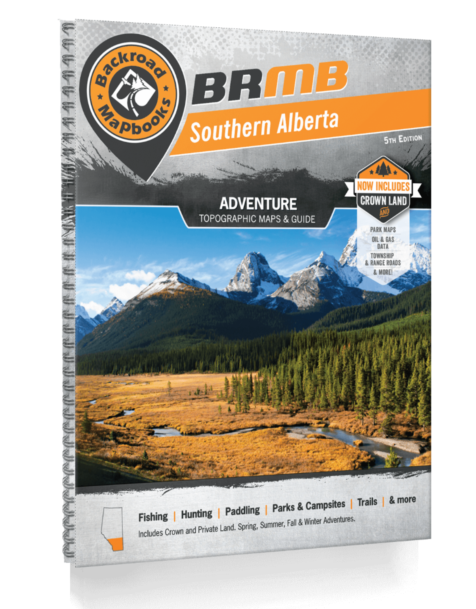
SOUTHERN ALBERTA
Map Features: Attractions, ATVing, Camping, Fishing, Hiking, Hunting, Paddling, Skiing, Snowmobiling, Hydrology, logging and industry roads
Areas Covered: Banff, Blairmore, Bragg Creek, Brooks, Calgary, Canmore, Carstairs, Cochrane, Crowsnest Pass, Drumheller, Fort Macleod, High River, Kananaskis Country, Lake Louise, Lethbridge, Medicine Hat, Okotoks, Olds, Pincher Creek, Sundre, Taber, Three Hills, & more.
From the imposing, world-famous peaks of the Rocky Mountains in the west to the seemingly endless fields of wheat and canola in the east, Southern Alberta is a land of great contrast, with recreation opportunities as diverse as its landscape. The Rockies are the most dramatic part of this region and attract hikers, campers and mountaineers from across the globe, while anglers and whitewater rafters ply and play in the mountains’ many streams. As you make your way east, you will discover fertile hunting grounds and endless ATV trails, with a wide-open prairie landscape that will stir your adventurer’s soul and inspire you to take the road less travelled.
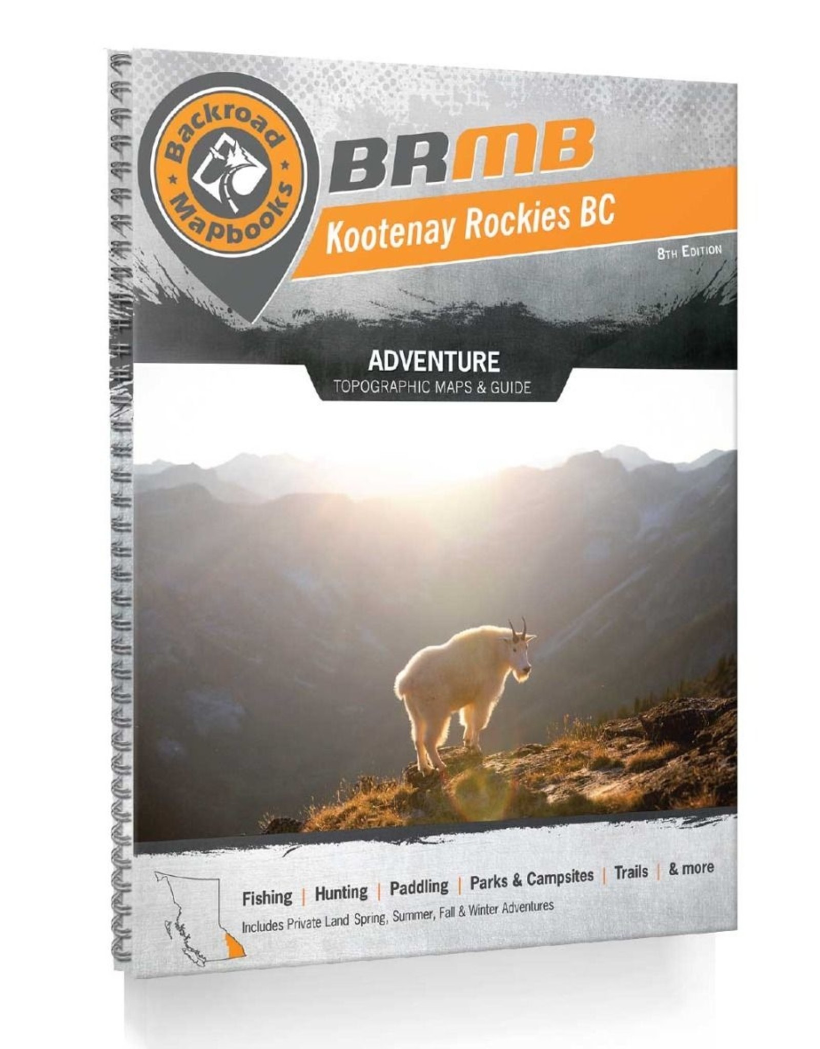
KOOTENAY ROCKIES BC
Map Features: Attractions, ATVing, Camping, Fishing, Hiking, Hunting, Paddling, Skiing, Snowmobiling, Hydrology, logging and industry roads
Areas Covered: Creston, Cranbrook, Fernie, Golden, Invermere, Kaslo, Nakusp, Nelson, Revelstoke, Trail, & more.
Tucked into the southeast corner of BC, the Kootenay Rockies are one of Canada’s best-kept outdoor adventure secrets. As you move west from the world-famous peaks of the Rocky Mountains, the crowds thin out and the opportunities for outdoor adventure grow. Forest-covered mountains hide sun-filled valleys, where rainbow trout swim in sparkling streams and deer graze along the shoreline. A maze of logging roads extends deep into the backcountry, offering access to countless campsites and hiking and mountain biking trails. In the winter, the region is covered by a thick layer of dry, fluffy snow, affectionately referred to by the locals as champagne powder.
To help you take advantage of this incredible region, the latest edition of our Kootenay Rockies Backroad Mapbook features extensive updates and upgrades from our last publication. We have updated our road network, added numerous multi-use trails and paddling routes and expanded our Adventure sections. This Mapbook also includes updated fish stocking and trail charts, private land and labelled fish species for the countless lakes, rivers and streams in the region.